

SITE LOGIN
-
REVIEWS
- Ski Gear
- Clothing
- Accessories
- Off-Season Gear
- Lifestyle
- Lodges and Accommodation
- Nutrition
- Manufacturers
- Destinations
- Training
- Gear of the Year
- Best New Summer Gear
-
Holiday Gift Guide
-
Holiday Gift Guide 2024
- Holiday Gift Guide 2024 Base Layers
- MSR Explore Revo Snowshoes
- Fieldsheer Backcountry Heated Jacket
- Fieldsheer Premium 2.0 Merino Heated Socks
- MEC Hut Booties and Slippers
- Arc’teryx Kopec GTX Shoe
- Arc’teryx Kragg Insulated Approach Shoes
- Gregory Verte 18 Backpack
- Grundens Deck-Boss Ankle Boot
- MEC Northern Light Vest
- Montec-Scope-Ski-Goggles
- Mountain Hardware Kor Airshell Hoody
- Mountain Hardware Kor Alloy Crew
- Arcade Atlas Belt
- Dynafit Ridge Dynastretch Jacket
- Shokz OpenRun Pro 2 headphones
- Buff Merino Move Multifunctional Neckwear
- Bootdoc Foot Warmer
- Cotopaxi Allpa 42L Travel Pack
- DPS LastBag
- DPS PHANTOM Glide At-Home Kit
- DPS Mission Quiver Roller
- Dragon Amped sunglasses
- Dragon DX3 Plus OTG photochromic goggle
- Fuse Lenses Anclote Flashback
- Garmin Fenix 8 Solar Sapphire Watch
- Gregory Alpaca Gear Tote 30
- Hotronic Boot Dryer
- MEC Aluminum Pot Set
- Gnara Go There Pants
- Grundens Shackleton 2.0 Duffel
- Jones Deeper 19L Backpack
- Le Bent Core Midweight Crew base layer
- Leatherman ARC
- Montane Nordes Hooded Softshell Jacket and Pants
- Helly Hansen Odin Everdown Hooded Jacket
- Helly Hansen Verglas Infinity Shell Jacket 2.0
- Montec Fawk Ski Jacket
- Pomoca Free Pro 2.0 Skins
- Rab Glaceon Pro Down Jacket
- Rab Khroma Converge GORE-TEX Ski Jacket & Pants
- Smith Squad MAG Goggles
- Stellar Guide Aerogel Hybrid Hood 2.0
- Stellar Ultralight Down Hood 2.0
- Arms of Andes Alpaca Half Zip & Wool Leggings
- Cotopaxi Allpa 70L Duffel Bag
- Giro Taggert Mips Helmet
- Loonr Hi Flyer Boots
- Paka Mountain Crew
- Roll Recovery SUPERPLUSH Classic Shoes
- Smartwool Smartloft Hooded Jacket and Pants
- Ortovox Switchback 32 Ski Touring Backpack
- Cotopaxi Allpa X 3L Hip Pack
- Giro Sagen Ski Goggle
- Icebreaker Ski+ Over the Calf Socks
- MEC-Fireside-Fleece-Snap-Pullover
- Montec Roast Mittens
- Mountain-Hardware-Sunblocker-Hoody
- MSR Titan Kettle 900 ml
- Tailgate-Industries-The Gondom-Goggle-Cover
- Wild Country Rope Tarp
- Bootdoc Race Merino PFI 50 Socks
- Remind Soles Destin Impact Insoles
- Kari Traa Rose Baselayer Half Zip Top and Pants
- Le Bent Midweight Quarter Zip
- Ombraz Dolomite Sunglasses
- Ortovox Fleece Rib Hoody
- Ortovox Merino Thermovent Base Layer
- Smartwool Intraknit Merino Tech Half Zip
- Suunto Wing Bone Conduction headphones
- Sweet Protection Adapter Mips Helmet
- Sweet Protection Connor Rig Reflect Goggles
- Zeal Optics Selkirk Glacier Glasses
- Norrona more flex1 Pants
- Norrona Octa Zip Hood
- Norrona Lyngen Alpha100 Zip Hood
- MEC Deluxe Pillow
- Holiday Gift Guide 2023
- Holiday Gift Guide 2022
- Holiday Gift Guide 2021
- Holiday Gift Guide 2020
- Holiday Gift Guide 2019
- Holiday Gift Guide 2018
- Holiday Gift Guide 2017
- Holiday Gift Guide 2016
-
Holiday Gift Guide 2024
- Pro Skier Interviews
- NEWS
- STORE
- ROUTES
- LODGING
-
VIDEOS
- 2022/23 Gear Reviews
- 2021/22 Gear Reviews
- 2020/21 Gear Reviews
- 2019/20 Gear Reviews
- 2018/19 Gear Reviews
- 2017/18 Gear Reviews
- 2016/17 Gear Reviews
- 2015/16 Gear Reviews
- 2014/15 Gear Reviews
- 2013/14 Gear Reviews
- 2012/13 Gear Reviews
- 2011/12 Gear Reviews
- 2020 Outdoor Retailer
- 2019 Outdoor Retailer
- 2018 Outdoor Retailer
- 2017 Outdoor Presscamp
- 2017 Outdoor Retailer
- 2016 Outdoor Presscamp
- 2016 Outdoor Retailer
- 2015 SIA Show
- 2014 Outdoor Retailer
- 2013 SIA Show
- 2012 Outdoor Retailer
- Tips and Tricks
- Backcountry Skiing
- SAFETY
- ABOUT
- REVIEWS
- NEWS
- STORE
- ROUTES
- LODGING
-
VIDEOS
- 2022/23 Gear Reviews
- 2021/22 Gear Reviews
- 2020/21 Gear Reviews
- 2019/20 Gear Reviews
- 2018/19 Gear Reviews
- 2017/18 Gear Reviews
- 2016/17 Gear Reviews
- 2015/16 Gear Reviews
- 2014/15 Gear Reviews
- 2013/14 Gear Reviews
- 2012/13 Gear Reviews
- 2011/12 Gear Reviews
- 2020 Outdoor Retailer
- 2019 Outdoor Retailer
- 2018 Outdoor Retailer
- 2017 Outdoor Presscamp
- 2017 Outdoor Retailer
- 2016 Outdoor Presscamp
- 2016 Outdoor Retailer
- 2015 SIA Show
- 2014 Outdoor Retailer
- 2013 SIA Show
- 2012 Outdoor Retailer
- Tips and Tricks
- Backcountry Skiing
- SAFETY
- ABOUT
TOP VIDEOS
Garmin InReach Explorer+
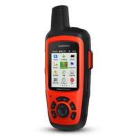
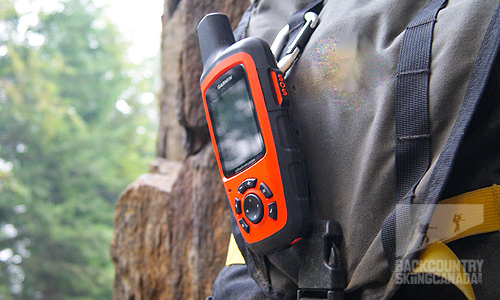
Having reliable communication in the backcountry is one of the greatest conveniences an adventurer to can have. Whether you are out climbing at your local crag or on a remote glacier for an extended mountaineering trip, communication is much more than a convenience. While there are several other emergency beacons available on the market there is an obvious leader. With a 24/7 global monitoring centre via the 100% global Iridium satellite network, the Garmin inReach Explorer+ is at the top of the list.
Small and light, the Garmin InReach Explorer+ is easy to take anywhere you need to stay connected.
- SHOW THE REST OF THE REVIEW / PHOTOS / VIDEOS
-
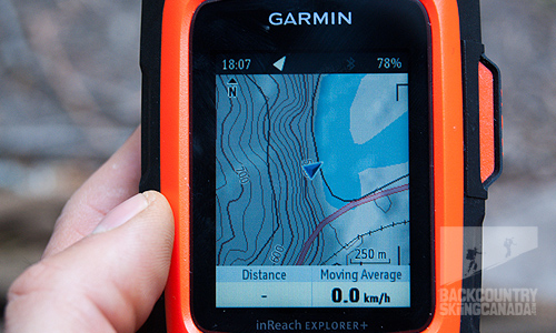
Garmin offers two Explorer models, the inReach Explorer SE and the Explorer+. The SE ( $449 ) offers the same messaging capabilities as the Explorer+ and has some GPS features like basic grid navigation, progress tracking, the ability to drop waypoints and includes a breadcrumb feature. The Explorer+ ( $589 ) is a full-featured GPS device and is preloaded loaded with high-quality TOPO maps right out of the box. In addition, it comes equipped with a built-in digital compass, barometric altimeter and accelerometer so that you can accurately navigate complex terrain.
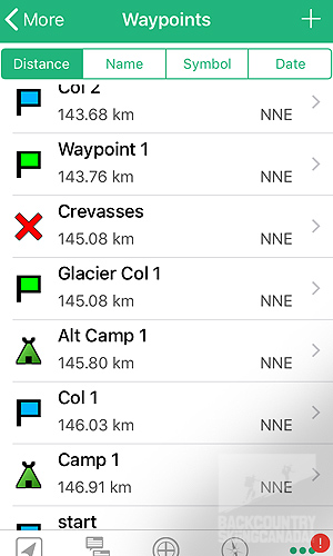
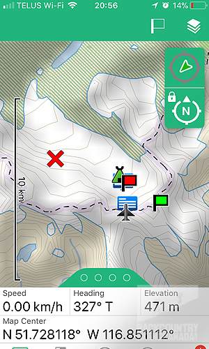
Included with every inReach device is access to the Garmin inReach website. This website allows you to create a route plan on a TOPO map by either drawing a route or by adding waypoints or points of importance such as important locations or hazards. The website is also where you can manage all your devices presets, emergency contacts as well as coverage plans and payments. Included on the website dashboard are your contacts, preloaded messages, quick texts, message history and linked social media accounts. It is via the inReach portal that your device is synced to your presets. It is worth a mention that you can simply type in any phone number on the device itself and text directly from the unit using the cursor/keyboard combo without the need of any preset information. This proves to be extremely handy when new contact information is received after you have left home for your trip. Another interesting feature is the ability to use Map Share. This feature allows others to follow your trip progress on a map almost live via a web portal which is a handy feature for those extended remote trips. If you choose you can link your social media accounts such as Facebook and post a status with your current location details which will show your location on a map.
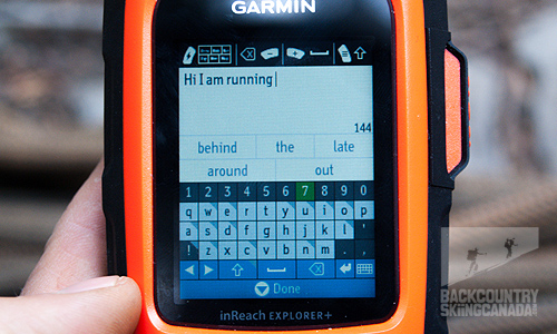
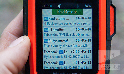
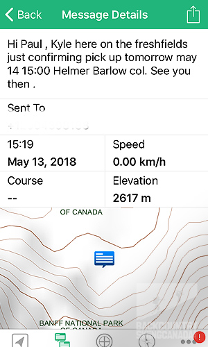
One of the biggest advantages of an inReach device over other brands is it's messaging capabilities. It's simple and easy. Just pair the device via Bluetooth to your smartphone, open the Garmin Earth mate app and type your message directly on your phone. Hit send and the inReach takes care of the rest. Receiving messages is similar to receiving a normal text message. An alert on your phone lets you know you when you have received a message. This feature works over several meters so if your device is in your tent, you are easily able to text while making dinner in the camp kitchen. Don't like to carry your phone? No problem. Simply open up the messages tab on your inReach device and create your own text via the cursor and keyboard or use your preloaded preset messages. The device has a predictive text feature that makes messaging via the device relatively pain-free.
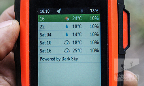
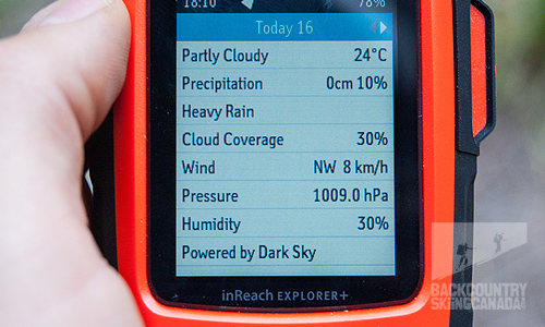
The most important factor in backcountry travel is the weather. Weather forecasts are forever changing and should only be trusted when looking a few days ahead. The inReach has a weather forecast feature that can be generated for your location or any other desired location. This provides a good snapshot of the upcoming weather and is an invaluable resource for decision making on longer trips.
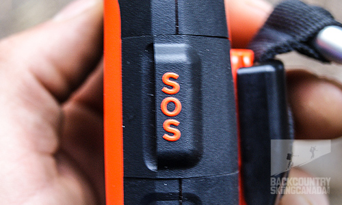
One of the most important features of the inReach is the SOS function. It's likely the main reason most would consider this device. Lifting the SOS cover and holding down the button activates an interactive SOS dialogue with a trained GEOS staff member. They will be in constant communication with you and provide you with updates as they become available. If you are able to resolve the situation on your own after initiating a response you have the ability to cancel your SOS. A short video of the process can be watched here.
Features:
- Weather resistant
- Battery: Rechargeable internal lithium ion
- Display type: transflective colour TFT
- Display size 3.5 x 4.7 x 5.9cm
- Display resolution: 200 x 265 pixels
- Memory: 2 GB
- Battery life: Up to 100 hours at 10-minute tracking mode (default); up to 75 hours at 10-minute tracking with 1-second logging; up to 30 days at the 30-minute interval power save mode; and up to 3 years when powered off
- Maps: Preloaded with a 1:24k map of the U.S. and Canada. Mexico also is included at a 1:125k scale
Verdict:
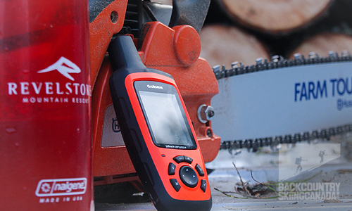
I have had the inReach Explorer+ for several months and have used it on ski mountaineering basecamps, ski traverses, day touring, rock climbing and while gathering a winter's supply of firewood. This device has added a measure of safety and convenience to all those activities. Having the ability to verify your position in relation to a pre-programmed route or proximity to a waypoint can mean the difference between a confusing walk in the fog or arriving at camp on schedule. Being able to access weather forecasts while in the remote backcountry was incredibly useful in our daily decision making. The battery life is exceptional. My longest trip was a six-day basecamp where I sent multiple messages daily, occasionally checked the topo map and received daily weather forecast. During this time the device was subject to sub-freezing temperatures and remained on the entire trip. I managed to consume a mere 15% of the battery's charge. All this in a 213g compact, weather resistant and durable package. Whether it's communicating with a helicopter pilot or changing a pickup location or just checking in on the family, the Garmin inReach simply works, every time.
 |
PROS:
|
 |
CONS:
|
SPECS:
Price: $589.99CAN / $449.99US
Weight: 213g / 7.5oz
Dimensions: 6.8x16.4x3.8cm / 2.7x6.5x1.5
RATING: 9.5/10
| Function 1.5/2 Battery life 2/2 Value 2/2 Reliability 2/2 Practicality 2/2 |
Did we miss something? Are we totally out to lunch? Let us know what you think. People like/dislike gear for different reasons so chime in below and we'll get a well-rounded evaluation. You'll need to login or register before you can comment but it only takes a few seconds, then you're good to go.
-
 Marc SchmidSeptember 25, 2018 00:40#Hi, as you stated " Basic service package somewhat limited " you should take a look at the alternative InReach dataplans provided by Protegear.com, they have more options and features:
-
 BSC AdminOctober 7, 2019 13:19#Good to know Marc, thanks for recommending—we'll do that.
-
Leave a Comment:
Copyright © 2023-24 Backcountry Skiing Canada. All Rights Reserved.


