Fall Hiking Hit List: Earl Grey Pass
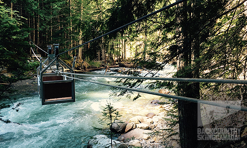
Solitude is a commodity in short supply in today’s busy world, whether it be backcountry skiing, paddling or hiking. At some point, you inevitably run into people and their associated infrastructure that has been created over the years. There seem to be few places where you can truly wander in nature for the better part of a week and not see a sole. The Earl Great pass is one of these places, and sure you’ll bear witness to a few decaying artifacts of a by-gone era, and the required cable-cars that have been refurbished for crossing Hamill Creek, but other than that you are alone in the woods in the middle of nowhere.
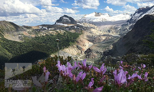
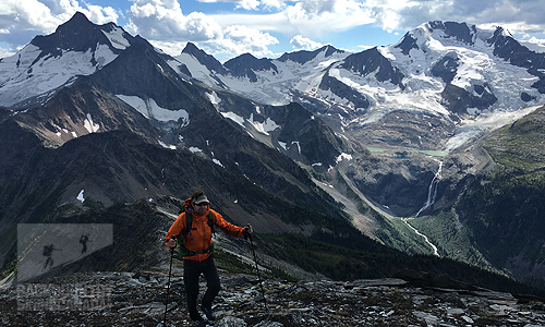
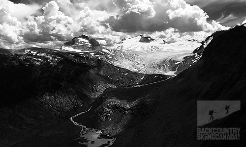
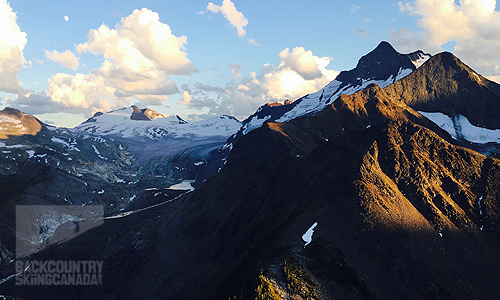
The Early Grey Pass is a historic 61km / 37.8mile hike through the northern edge of the Purcell Wilderness Conservancy where there are no roads, huts or best of all people. The highlight of this 3-5 day hike is Slate Peak which sits at 7,480ft and provides 360° views of the surrounding Purcell-range in all its splendor. Slate Peak is a short 50-minute hike from Earl Grey Pass proper. Be sure to scramble up the peak to witness the confluence of Toby and Hamill Creeks which are literally at your feet as are ridges, summits, and sprawling glaciers. You’ll have front row seats to view glacier covered Mt Hamill to the southwest along with10,237ft Mt. Lady Grey, and 9,712ft Mt. Hyak. To the north, you’ll be wowed by 10,050ft Blockhead Mtn. 10,500ft Caldron Peak, 10,200ft Mt. Quibble and 10,100ft Ochre Peak. These views are only made better by the fact that you’ve been on trail for several days and have likely yet to see a single person. As the summit registry on Slate Peak attests to, only a handful of people enjoy this sensory spectacle each year.
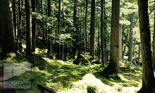
Our group of two (plus one four-legged friend) started our adventure a stone's throw from the north end of Kootenay Lake, outside the barely recognizable town of Argenta. We spent three sunny days working our way up the Hamill Creek drainage under cover of thick forests and lush vegetation with no real views of any kind. Along the way, we were treated to the splendor of old growth forests, rustic cable car crossings and the evidence of mining operations from yesteryear. The campsites dispersed along the trail were very sparse and ill-maintained as was the trail itself in sections. For a brief three kilometers of the route, we found our selves off trail but not lost as there was evidence that others had made the same mistake as we had.
After a few days the trail slowly climbed out of the forest and gave way to epic views of mountains and glaciers, we had arrived at Earl Grey Pass. This would be our camp on night three but it would be a hard fought reward as there is no water at the pass we had to ensure we packed enough up to sustain us for the hot afternoon and morning to follow. After spending the better part of a full day exploring around Earl Grey Pass and ascending Slate peak twice (once for sunset), we camped that night and then started our descent down into Toby Creek the following morning. Given that this is the faster way up to the pass, the trail on the East side is easy to follow and you can easily relax and just put left in front of right as you enjoy the forest, avalanche paths and views in the rearview mirror. In sections, the trail is muddy and beat up due to horse traffic but it didn’t pose any real problems. After our fourth and final day of hiking, we ended our trip by camping beside a smaller tributary of Toby Creek approximately 19km west of Panorama Ski Resort which is just outside of Invermere BC.
While the transportation logistics are challenging for this hike, it’s still a huge “must do”. Getting someone to drop you off at the trailhead just outside of Argenta is easy enough but having a car waiting for you at the other end is the real challenge. This is because from Nelson on the West side of the hike (where we started from), you are looking at a 6-7 hour drive (one-way) to drop off a vehicle for your return trip so it’s ideal to find another group (perhaps online) who is taking on the hike from the East side, in the hopes that you can meet in the middle and simply swap car keys.
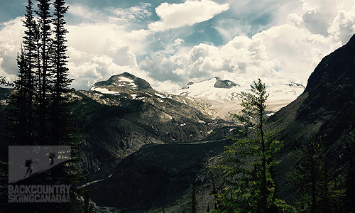
Don’t let the remoteness, abundance of over-the-head devils club or trail finding challenges deter you, however, the Earl Grey Pass hike is a rare experience that will allow you the solitude and time with nature you are searching for.
Logistics
Directions to Toby Creek – East end of Trail Toby Creek is accessible by a secondary road north of Invermere. Follow the signs to Panorama Resort (18km). From the Resort, follow the main gravel road (20km) alongside Toby Creek to the abandoned Mineral King mine. After crossing the bridge over Jumbo Creek, just past the mine site, keep left and continue past a horse corral for about 1km. Take the right fork and follow it uphill to a parking area. It is a short (200m) walk to the Park Boundary and trailhead.
Directions to Argenta – West end of trail
Argenta is accessible by secondary road from Highway 31 north of Lardeau. Follow the main road through the community for 4.5km beyond the Post Office/Community Hall to reach the trailhead.
Water: There is no water at Earl Grey Pass so be sure to pack up all that you’ll need. Along the rest of the route, there is ample water for filtering and boiling in order to purify.
Cable Cars: Bring gloves as the cable cars do not always move as efficiently as they could and you’ll be called upon to muscle your way across Hamill Creek a total of five times. Gloves will save you from ripping your hands apart as I did on the very first cable car.
Campsites: Campsites are rare, small and not maintained very well so limit your group size and don’t expect much.
Outhouses: There are no outhouses of any kind along the trail so be prepared and knowledgable on how to bury your waste and of course pack out all your garbage.

Itinerary
Day One: West end of the trail to Boy Scout Camp Site — 15.5km / 9.6miles, 7.5hrs
Day Two: Boy Scout Camp Site to North Forks Camp — Site 20km / 12.5miles, 7.5hrs
Day Three: North Forks Camp Site to Earl Grey Pass — 8km / 5miles, 3hrs, 823m/2,700ft climb out of the valley
Day Four: Earl Grey Pass to the East end of the trail — 18km / 11.2miles, 6hrs
View our route and all the trail specs here on our Gamin Connect Page.
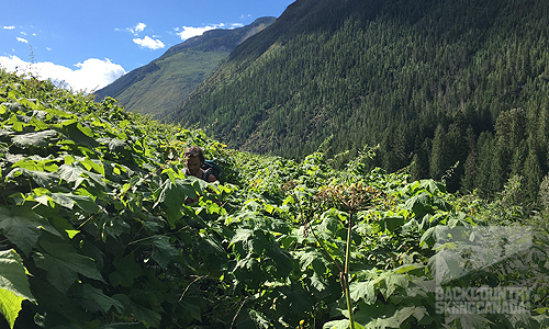
Yes, that's the trail and if you look hard enough you'll see my hiking partner in there somewhere.
Details
Distance: 61km / 37.8mile
Hiking Time: 3- 5 days
Elevation Gain: 1,525m / 5,000ft
Cable Car crossings: 5
Hamill Creek Crossings: 7 (including the 5 above)
Difficulty: Challenging - you’ll need good route finding skills as the trail is very overgrown and hard to find (we got off trail for 3km but you can never wander far as you are always in a valley)
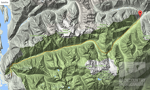
Maps
1:50,000 scale topographic maps 82K/2, 82K/7, and 82K/8. Here you will find the maps for the Eastern section and also the Western section.


