Valhalla Provincial Park - Last hike of summer?
Mt. Dag Valhalla Provincial Park
Last weekend seemed to be the last 'true' summer weekend in my opinion. It was sunny and 30°C in the valley and over 25°C in the alpine. Not one to let conditions like this pass me by we planned a family hike into the alpine to enjoy what could of the last true weekend of summer and judging by todays rainy 10°C weather I am sure glad we did.

(give a click on any of the images for a larger view.)
Details on day one, the access and our camp location are over here.

The objective for this trip was Mount Dag in Valhalla Provincial Park just west of Slocan Lake in the West Kootenays near Nelson BC. It's a 2 hour drive (most of this on rough forestry roads) to the Mount Gimli parking lot, however we stopped 600m shy of this as the approach to Mount Dag starts where the old Gimli access road leaves the new road. To get a better sense of these direction have a look at the GPS data I captured with the soon to be reviewed Suunto Quest GPS Watch. All of the data is stored on our Backcountry Skiing Canada Movescount.com page here.

The details to Mount Dag are over here on our Movescount.com page.

After a few km of bush whacking up the old access road we reached the old parking lot and from here we found the cairn that indicated that the trail headed due North and straight up. As we climbed higher the huckleberries were in all their glory and the feel of fall was in the air except for the fact that it was a real cooker in the sun. We quickly lost the old overgrown trail but after 2 hours and roughly 622m of climbing we arrived in the alpine with big views of Mount Gimli across the valley and the sun waiting to set. We quickly set up camp and settled in for dinner and planned our route for day two. Thanks to an almost full moon it was easy to rise at 5:30am and after a leisurely breakfast be ready for walking by 8:00. The plan was to climb up and over the ridge directly North of our tent and then descend into the next valley where we would get a full-on view of our objective. Travelling was slower than usual as this was a family trip and we had to carefully pace our 10 year old son or else he would quickly burn out or melt down before we even got close to the summit.

Having climbed Mount Dag eight years prior I had a pretty good idea of the correct route but once on the steep south face I quickly realized that my memory was not nearly as good as I wished. The South face is steep and it's easy to get off course. The only real detail I could remember was that there was a small 10' chimney that you needed to find in order to gain the long summit ridge. After a hour or so of failed attempt to locate the chimney I decided to take a different route to the ridge then down climb the proper route so that the rest of my family could ascend with out excessive exposure. After quick success of this plan we were on the long summit ridge and on our way to the summit for lunch. Mid way along the ridge a quick pep talk with our son was needed in order to boost morale as he ready to pack it in. We soon found ourselves on the 2,744m summit and enjoyed spectacular views into Mulvey Basin which is surrounded by Wolf's Ears, Gimli, Midgard, Asgard and Gladsheim peaks.

Since we were technically only half way and day light hours are short this time of year we didn't spend enough time on the summit before re-tracing our steps back to the chimney and down climbing the challenging South Face. Once back in the basin our next objective was the alpine lake we passed on the way in for much needed dip to cool off before once again going up and over the ridge and back to our camp.
Wolf's Ears loom over the alpine lake that provided us with a much needed rest stop.

Access to the valley below Wolf's Ears and Mount Dag is via a cool little grassy ramp that looks almost made to order for the route.

The day took it's toll on our son who was not used to walking for eight hours let alone eight hours of hiking with over 1,400m of elevation gain. He survived, mostly due to the alpine swim and we again enjoyed a warm sunset to complete the day.
Our Mountain Hardwear Skyledge 3DP tent basking in the alpinglow.

The next morning the route back to the car was not the most direct nor easy (again if you are 10) but we made it to the car our by lunch and were able to get in one more swim, this time at Cresent Beach on the Slocan River just outside Nelson.
Looking back one week I am pretty sure that that was the last summer hike of the season and glad to have added in a few lake swims to seal the deal.
Gear used:
Mountain Hardwear Phantom 32 Down Sleeping Bag

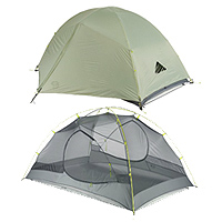
Mountain Hardwear Skyledge 3DP Tent
Klymit Inertia X Frame Sleeping Pad

![]()

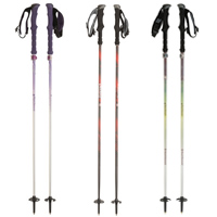
Black Diamond Ultra Mountain Carbon Trekking Poles
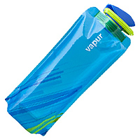
Vapur Element Anti Water Bottle

Suunto Quest Watch with GPS POD (Review due soon, read about the Suunto Ambit2 GPS Watch until then)
