Kokanee Glacier Research
Canadian glaciologists know quite a bit about glacier area in the Canadian portion of the Columbia River Basin (CCRB) thanks to satellite imagery. Unfortunately, they don't know as much about annual glacier thickness change and snowpack gradients, which are useful for glacier modelling. Modelling has been useful in predicting glacier-melt contributions to streamflow from small basins to large ones and help estimate contributions to sea-level rise.
There are glacier monitoring sites in the Coast Mountains and in the Rockies, but only recently have there been sites in the CCRB. To improve our understanding of glacier change in the basin the Columbia Basin Trust has supported University of Northern British Columbia to establish some monitoring sites in the CCRB. Kokanee Glacier is one of them.
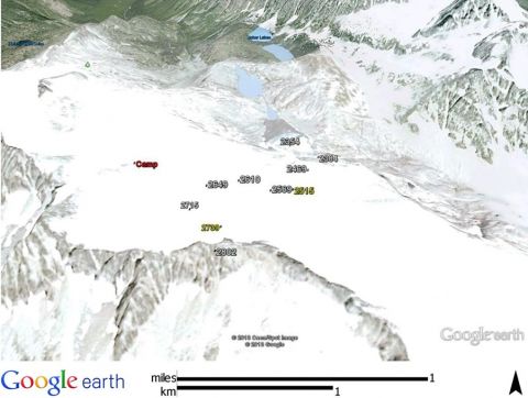
On May 5-11 we setup a glacier mass balance stake network on the Kokanee Glacier from Cond Peak to the glacier terminus above Joker Lakes. We found an average snow depth of 4.8 m, which made for long days digging to ice. The two pits (indicated by yellow on the map) were refilled, but could pose a hazard as the pits melt out.
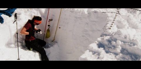
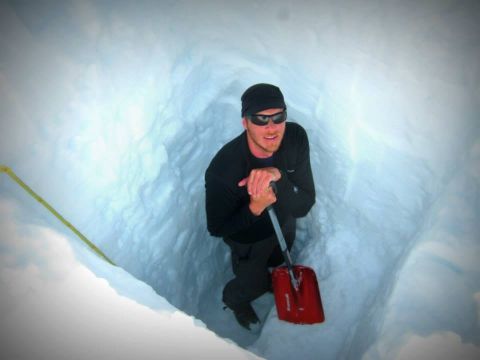
(left) Jocelyn collecting snow density samples, and (right) Chris digging 5 m down to glacier ice.
The stakes are aluminium poles drilled into the snow or ice. Please do not move these poles, as they provide crucial scientific data to gauge summer and winter gains and losses of the glacier.
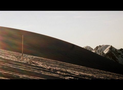
Aluminium stake (photo by Jocelyn Hirose).
The approximate locations of the poles are shown here:
What can you do?
If you're skiing or hiking around the stake network and see the poles leaning over significantly or completely tipped over please give us a heads up by posting your comments on this forum, but please do not move the poles from where they lie.
Thank you and keep enjoying the majestic white beauties in your backyard!


