The Trickster strikes. A Mt Loki Hike report
Mt Loki soars to 2779m above the northern half of Kootenay Lake, visible from the western shore, a pyramidal summit rising above the forested mountains. It is pretty clear, even from a distance that this is not a stroll in the woods, but a full-day hike. The distance is logged at 12.8km with an altitude gain of 1,179 m. As you can see the summit ridge from many places along the lake, it goes without saying that the views are spectacular, but more on that to come.

From Nelson, the best way to start the day hike to the summit is to take the ferry the day before and camp at one of the campsites near the bottom of Portman Creek FSR in order to get an early start. Unfortunately, due to an accident on the road to the Balfour to Kootenay Bay ferry, this proved impossible. We started out by leaving Nelson at 5:30 to make the 6:40 ferry in the morning. Having met up with the rest of the crew, who were camping at Riondel, around 10 km from the bottom of the Portman Creek FSR, and had a leisurely breakfast, we started the 20 km drive to the trailhead. The FSRs were both in pretty good shape this year, so it only took 35-40 minutes to get up to the Loki trailhead, even in lower-clearance AWD vehicles. The issues that we were expecting to find on the road never materialized, and in the small parking lot, there was a minivan that had made it up without seemingly having issues.
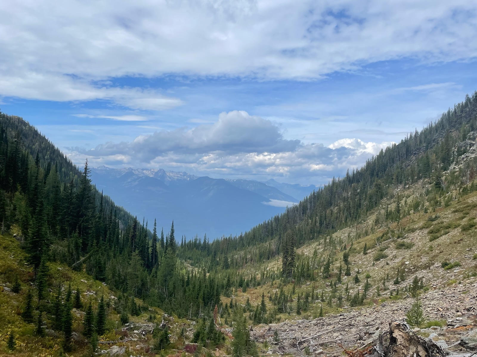
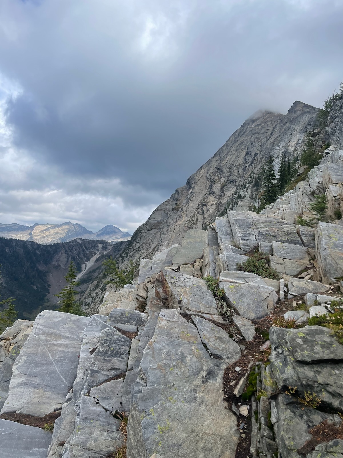
From the small parking area on the FSR, at approximately 1600m, the trail climbs through the inland temperate rainforest of the Purcell range for around an hour of reasonably strenuous hiking. Fairly easy sections are interspersed with steeper climbs, all shaded in the forest, with occasional views across the lake. This trail leads to a subalpine meadow, with the remnants of previous avalanche cycles visible in the trees strewn around the marshy area. From there the trail gains altitude quickly to Portman’s notch. From the vantage point of this col, the ridge leading to the top can be seen, and the gravity of the next stage of the hike/ scramble becomes obvious. The hike carries on rolling through the forest along the ridgeline for another 30 minutes or so until a talus field is reached. The way across is marked with cairns, and it is easier to stay next to them, although there are many options to get across. The aim is to head to the lookers right highest point of the talus field, and back into the last treed section before the trail to the summit steepens. Even where the trail is obvious, and the cairns easy to spot, these rocks can be loose. So be aware of your footing. This is where the hike starts to become a scramble in places. To this point, our group had taken 1hr and 40 minutes. From this point, the trail goes along the summit ridge. The scramble becomes a climb at places along this ridge, and with a long drop to the left, it can feel very exposed. Be aware of this if you’re choosing to do this hike.

We had started a little late, and the forecast had been for some showers in the afternoon with the possibility of a thunderstorm later in the evening. At this point, the sky started to cloud over, and the group began moving a little quicker to attempt to reach the summit before the weather came in. The weather comes in quickly in the Purcells, and as we reached what we thought was the false summit, Loki itself became shrouded in cloud. It turned out we had been tricked again, Loki living up to his name. This was one of two false summits. As the majority of our group started to climb the second false summit, the weather came in, and it started to hail. Visibility became around 4ft, and we all decided we would turn around, as it was unlikely we could see the cairns needed to ensure safety on the trail along the ridgeline. This meant that we never got to see the views from the summit, but those from the first false summit were breathtaking.
The trail involves some interesting downclimbing on the return to the trailhead, especially along the summit ridge and through the talus field. Once clear of those sections, though, you are back to a well-maintained trail through the forest. It is a hike that showcases the best of the Kootenays, mixing sub-alpine strolling with steeper sections and the challenge of exposure, with the view of most of the mountain ranges of Kootenay Lake from the top. Having not made it to the top, it is definitely on the list to go again.
When attempting Mt Loki, it is advisable to carry more water than you would think, as there is nowhere to fill up on the hike. Also it worth, even in summer, carrying an extra layer due to the temperature change with the altitude gain, and the wind at the summit.


