GARMIN SHARES SOME DATA REGARDING INREACH SOS TRIGGERS
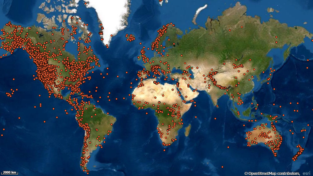
Garmin recently released some interesting data regarding SOS triggerings on their inReach devices. As personal GPS satellite communicators, they are carried by backcountry users around the globe as a means to stay connected or to use in emergency. According to a heat map published by Garmin sharing the general locations of their inReach SOS triggers to date (about 10 000 triggers so far), one can clearly see areas and regions throughout the world where these devices have most been used as a call for aid.Hot spots with dense clusters of dots indicate mountain regions like western US and Canada, the Alps, and all of New Zealand.
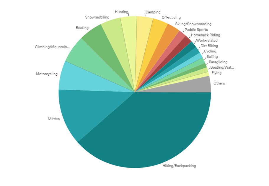
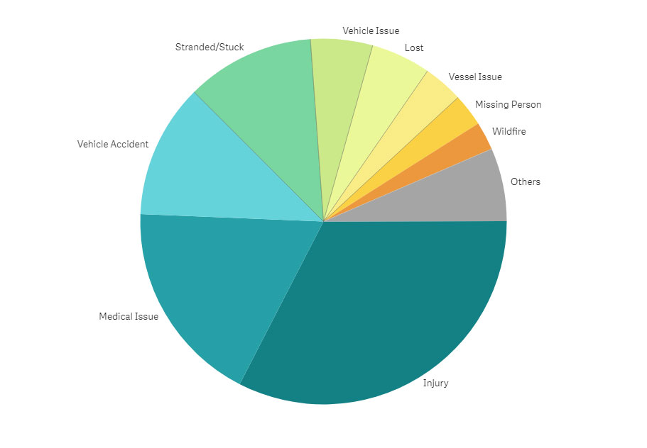
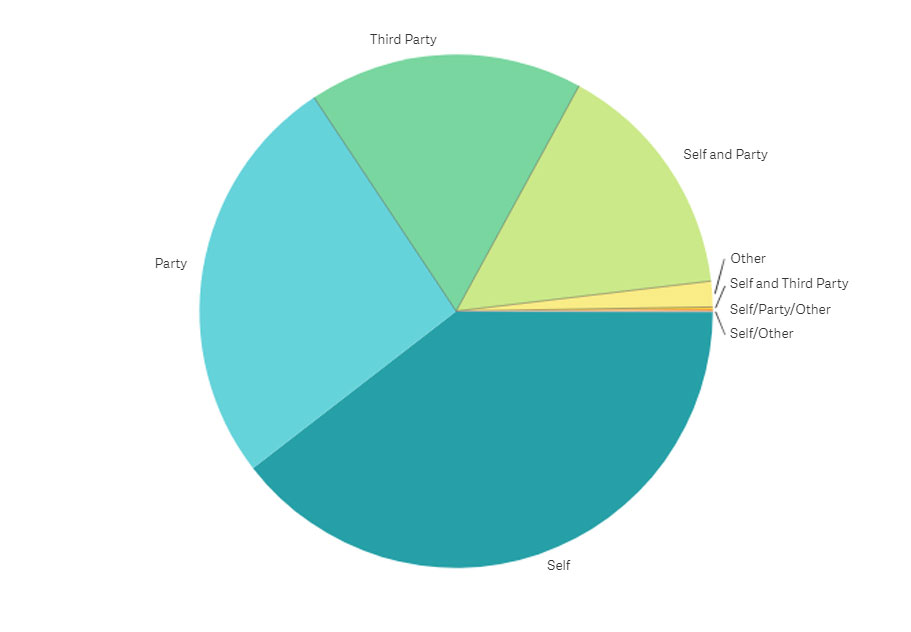
Garmin has taken it even further though, and have charted more data to determine who people are triggering an SOS for (themselves, their party, third party, etc.), why they have needed aid (injury/medical issues, vehicle accidents, lost, etc.) and what activity they were participating in. Although Injury and Medical issues are around 50% of SOS trigger causes, 20% of all calls are made for a third party, and only around 5% of all total triggers are from skiers and snowboarders. Feel free to nerd out on these pie chart below, like I did:
Pretty neat info! You can check out the full posting by Garmin right here.


